what is Astro 430 Garmin?
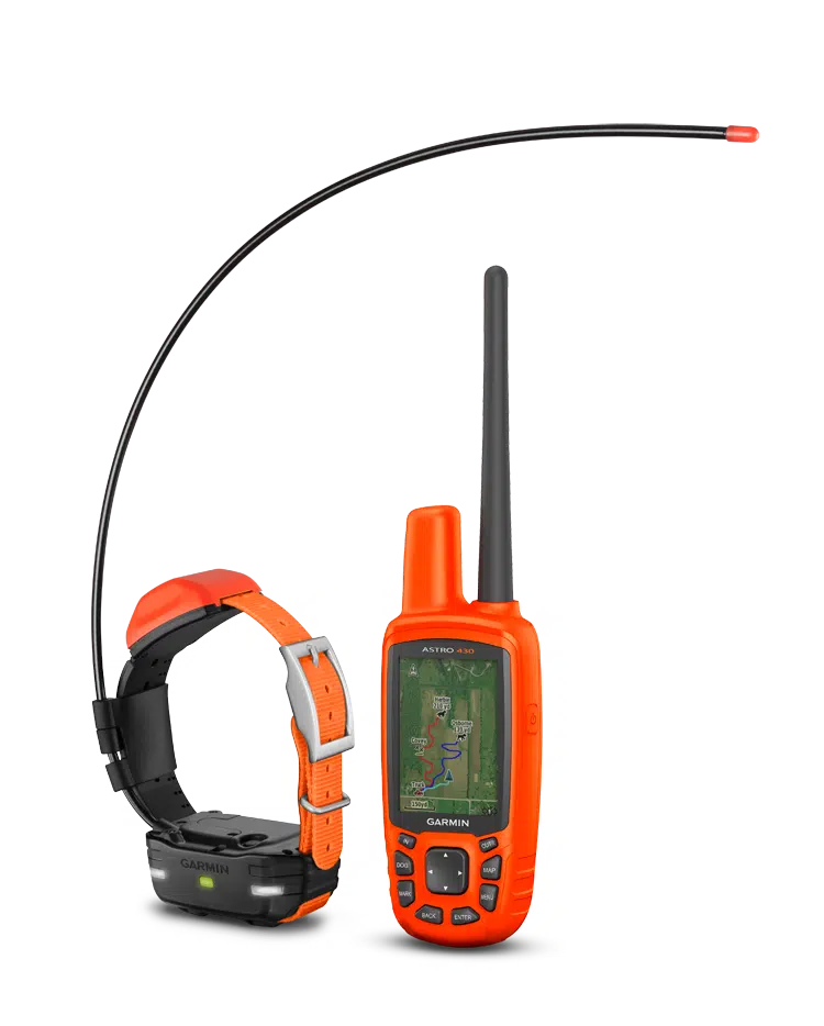
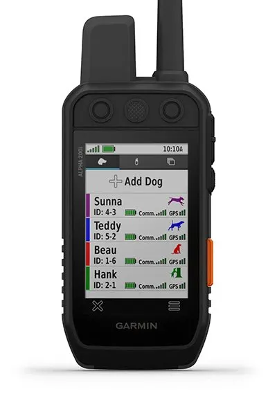
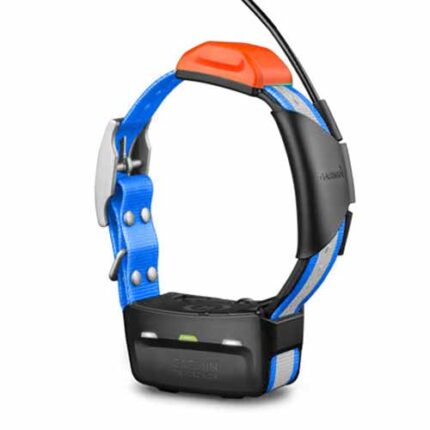
Garmin 430 astro is a handheld GPS dog tracking device that can be bundled with a T 5 collar device for a tracking range of up to 9 miles.
Garmin astro 430 reviews
- Track up to 20 dogs at a time, with ranges up to 9 miles using a Garmin T 5X collar device or up to 4 miles with T 5 mini collar device
- When your dogs are on the run the faster 2.5-second update rate provides faster dog location tracking
- GPS/GLONASS reception enables better satellite tracking in challenging environments than GPS alone
- Comes with preloaded TOPO U.S 100K mapping and a free 1-year BirdsEye Satellite Imagery subscription; compatible with Garmin HuntView cards
- Hunt Metrics data helps analyze your dogs’ hunting patterns and behaviors; view distance traveled, time afield and more
how to use Garmin astro 430?
Garmin astro 430 (sold separately) to transmit each dog’s location as often as every 2.5 seconds,
Garmin Astro 430 review
You also can switch over to the Dog Track page to view a compass pointing to your dog’s location. For help in keeping the big picture in sight when tracking multiple dogs, it’s easy to auto zoom the map page, so all dogs can be seen on the display at any time. Dogs that are too far away to fit on the map’s current zoom scale can be notated on the display’s margin in the direction of the dog’s location.
astro Garmin 430
To reduce visual clutter on the map, you can toggle between “show all,” “show some” and “show none” — selecting the duration that each dog’s track is view-able on the display. You can also share a dog’s track code so another person can view your dog’s location on their unit’s map, along with the dog tracking compass. Further, by sharing a dog’s control code, you can allow another person to configure and control your dog’s on-collar device.
does the Garmin astro 430 allow for stimulation
Garmin Astro 430 discontinued
In addition, astro 430 Garmin (free 1-year subscription included) so you can download satellite images to your device and integrate them with your maps. The Astro’s mapping depicts important nearby geographical features and enables you to see if your dog has crossed a creek or is nearing a dangerous roadway.
Garmin ASTRO 430 T5 is also compatible with Garmin Custom Maps, free software that transforms paper and electronic maps into downloadable maps for your device.
astro 320 collar
Sophisticated Hunt Metrics help monitor your dog’s hunting patterns and behaviors to optimize your training opportunities. You can see your dog’s times, distances traveled and overall scores. Plus, the Garmin Astro 430 will also capture the number of times during the hunt when an “on point” or “treed” event was indicated.
astro 430
After you’ve tracked down your quarry, mark the exact spot with Astro’s Covey Counter™, a special waypoint that shows the exact location, time of day and elevation where you found your prey as well as the number of birds you flushed and took from that location. Garmin ASTRO 430 lets you save other special waypoints, such as “Truck” and “Lodge,” so you can easily find your way back to these locations at the end of the hunting-related points. astro 430
how to track a hike with Garmin astro 430?
Plan for a more productive hunting trip with BaseCamp™ software, which lets you view and organize maps, waypoints, routes and tracks. This free trip-planning software even allows you to create Garmin Adventures that you can share with friends, family or fellow dog trackers. 430 astro.
Garmin Astro 430 price
BaseCamp displays topographic map data in 2-D or 3-D on your computer screen, including contour lines and elevation profiles. It also can transfer an unlimited amount of satellite images to your device when paired with your Astro’s free 1-year BirdsEye Satellite Imagery subscription. astro 320 collar.
Garmin Astro manual
Likewise, fēnix® 3 GPS watches can receive dog status updates and alerts for viewing at a glance on your wrist. Also, while you’re in the field, Astro 430 lets you link and share wirelessly with your buddies’ compatible devices, such as the Oregon® handheld, Montana® handheld, GPSMAP® 64 chartplotter or other ANT+® enabled devices, to help coordinate hunt logistics on the go. garmin astro 430 reviews.
KEY FEATURES – Garmin ASTRO 430
| NEW | EXPANDED DOG CAPABILITY | Track up to 20 dogs1 from a range of up to 9 miles2 | |
| NEW | GPS/GLONASS | High-sensitivity GPS and GLONASS satellite reception has the ability to track in more challenging environments than GPS alone | |
| NEW | FASTER UPDATE RATE | 2.5-second update rate provides faster location tracking when dogs are on the run | |
| NEW | PRELOADED MAPPING | Includes preloaded TOPO U.S. 100K mapping and a free 1-year BirdsEye Satellite Imagery subscription3 | |
| NEW | HUNT METRICS | Hunt Metrics dog performance data shows distance traveled, time afield and more, so you can train your dog more effectively | |
| NEW | DESIGN | Vibrant orange design makes it difficult to lose in the field | |
| NEW | GARMIN DRIVETRACK™ | In-vehicle dog tracker and GPS navigator syncs wirelessly with your compatible Astro 430 handheld to help track and retrieve your sporting dogs in the field | |
| NEW | fēnix® 3 COMPATIBILITIES | Receive dog status updates and alerts using your fēnix 3 GPS watch | |
| NEW | COMPATIBLE DOG DEVICES | Compatible with a variety of dog devices: T 5, T 5 mini, TT™ 15, TT 15 mini, DC™ 504, TT 10 and newer models (provides tracking only; sold separately) | |
| NEW | OPTIONAL BATTERY | Optional in-unit rechargeable NiMH battery pack or uses standard AA battery power | |
| DOG NOTIFICATIONS | Receive notifications when a dog is “Treed” or “On Point,” plus set up and receive bark status alerts | ||
| VIBRANT DISPLAY | Sunlight-readable, glove-friendly 2.6-inch color display | ||
| COMPASS/ALTIMETER | 3-axis electronic compass and barometric altimeter | ||
| WIRELESS CONNECTIVITY | Wirelessly connect to a variety of compatible Garmin devices, including VIRB® action cameras and ANT+® sensors such as tempe™ | ||
| WATER RATING | Handheld device water-rated to IPX75 | ||
| ADDITIONAL MAPPING | microSD™ card slot and support for TOPO U.S. 24K, Garmin HuntView™, City Navigator®, Garmin Custom Maps and more (all sold separately) | ||
| BASECAMP™ | Free trip-planning software that lets you view and organize maps, waypoints, routes and tracks – and then share with friends, family or fellow explorers | ||


 GPS Dog Collars
 Sleeping Bags
 compound bows
 CAMPING TENT
 Sitka Hunting Clothes
 Backpacking






Reviews
There are no reviews yet.